
Competition area
Course World Predator League 2025
The course is confirmed! Stay within the indicated boundaries (red lines on the map) and follow Dutch legislation. See the attached Visplanner map and the speed limit maps from Rijkswaterstaat.
Main rules:
-
No fishing in the navigation channel.
-
Adhere to speed limits; in fast-speed zones on the Haringvliet, max. 20 km/h applies.
-
Keep a minimum distance of 150 metres from locks and bridges.
-
Do not enter or fish in side branches of the main waters.
-
No fishing in nature reserves or Natura 2000 areas (white signs).
-
No fishing behind yellow buoys with a red top or a red-white-red striped top.
-
Red-striped areas on the map are prohibited zones.
Note: Buoys may be positioned differently than shown on the map. The actual situation on the water is always leading!
Violation of these rules may result in disqualification.
Tips:
-
Check prohibited areas (yellow buoys with red-white-red tops) and/or buoy lines via www.waterkaart.net.
-
Download the Savvy Navvy app (€69/year) for nautical charts, prohibited areas, routes, etc.
-
Check speed limits at www.varendoejesamen.nl.
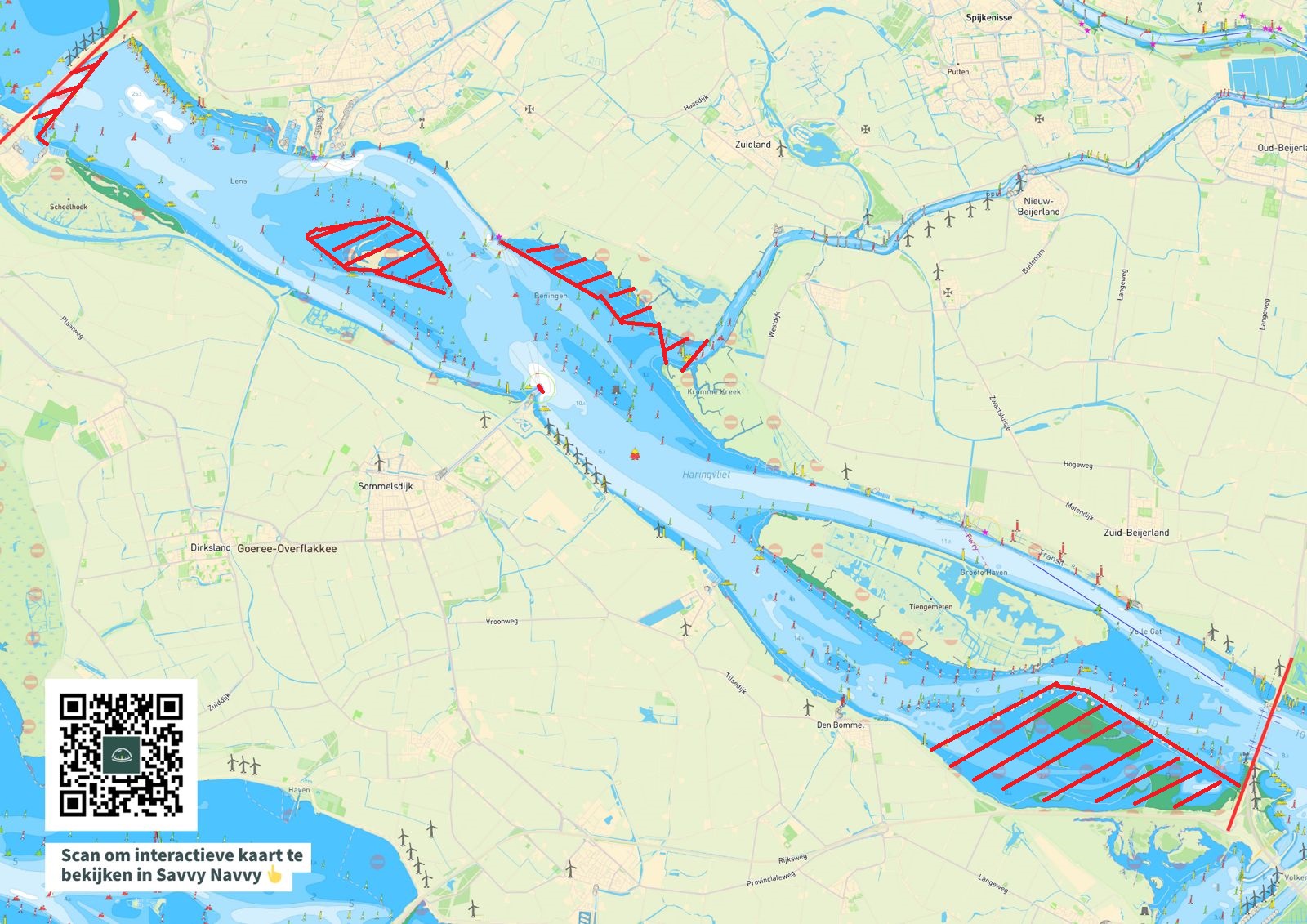
Haringvliet (Click on the image to enlarge the map)
 |
 |
|
Course map by the organisation (Source: Savvy Navvy)
|
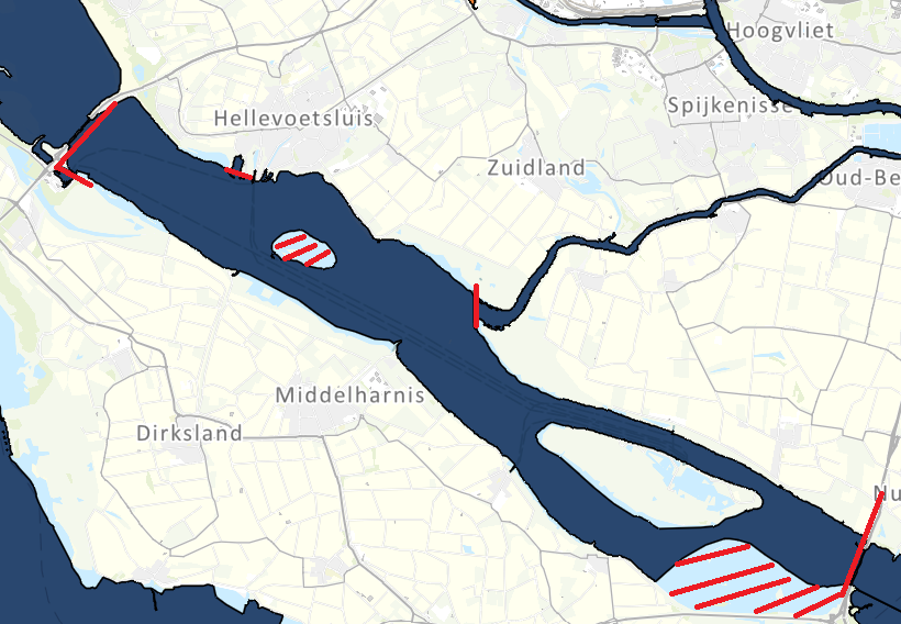
Sportvisserij Nederland map (Source: vissplanner.nl)
Note: Possession of either the Visplanner app or waterbooks is mandatory with your permit.
|
 |
|
|
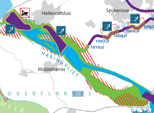
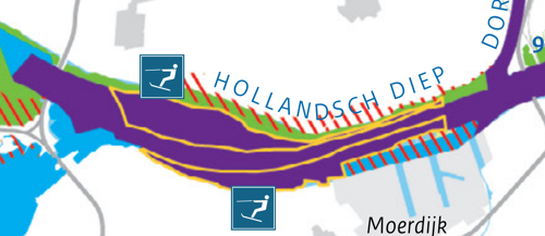
Fast-speed zones (Source: www.varendoejesamen.nl):
|
|
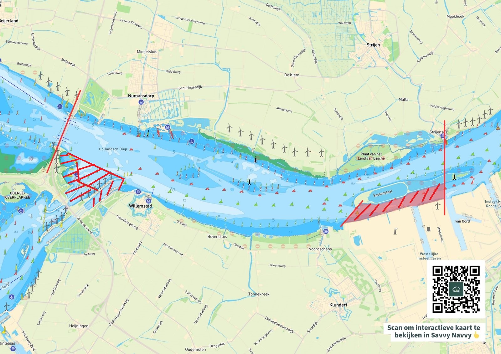
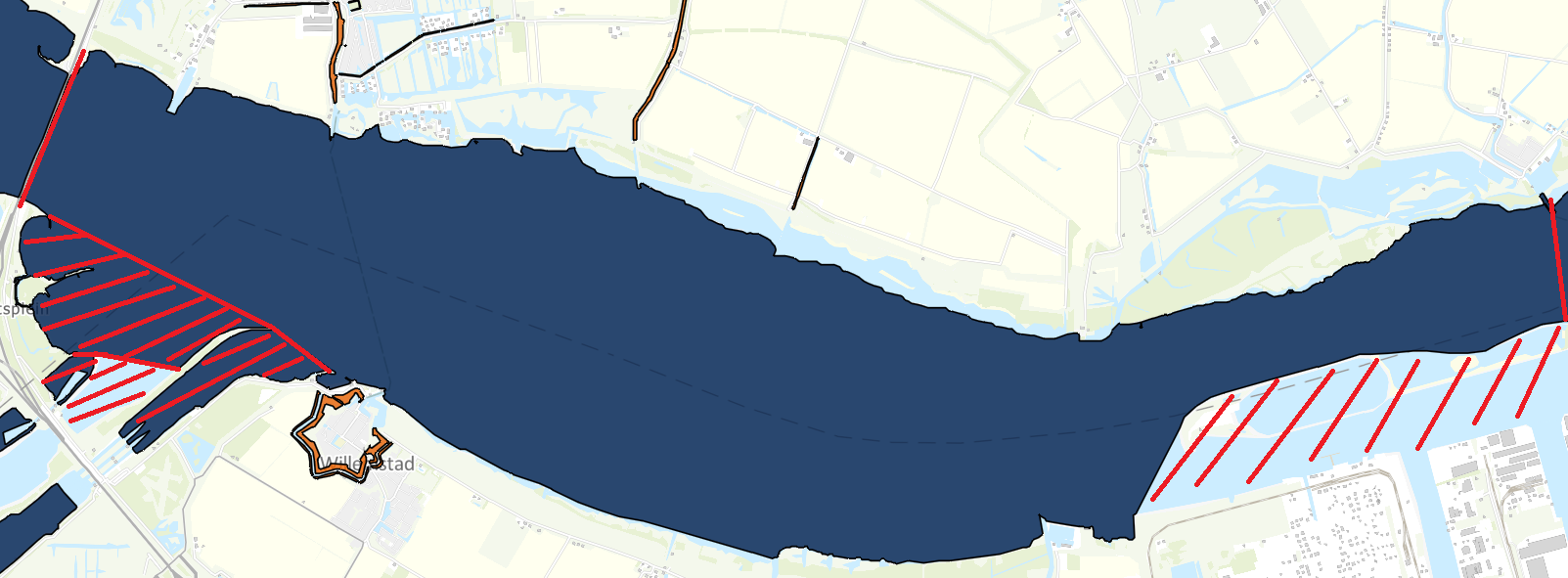
Hollands Diep (Click on the image to enlarge the map)
 |
 |
|
Course map by the organisation (Source: Savvy Navvy)
|
Sportvisserij Nederland map (Source: vissplanner.nl)
Note: Possession of the Visplanner app or waterbooks is mandatory. Prohibited areas such as Natura 2000 and yellow buoys with red-white-red tops are not shown on this map.
|
 |
|
|
|
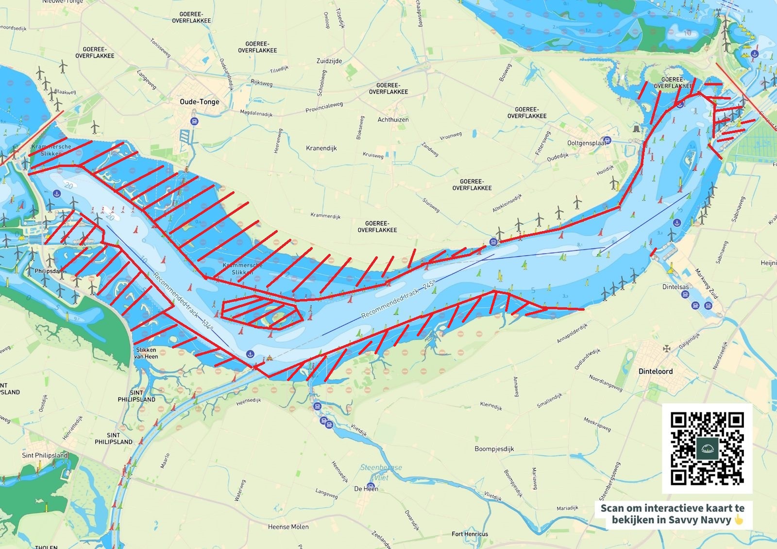
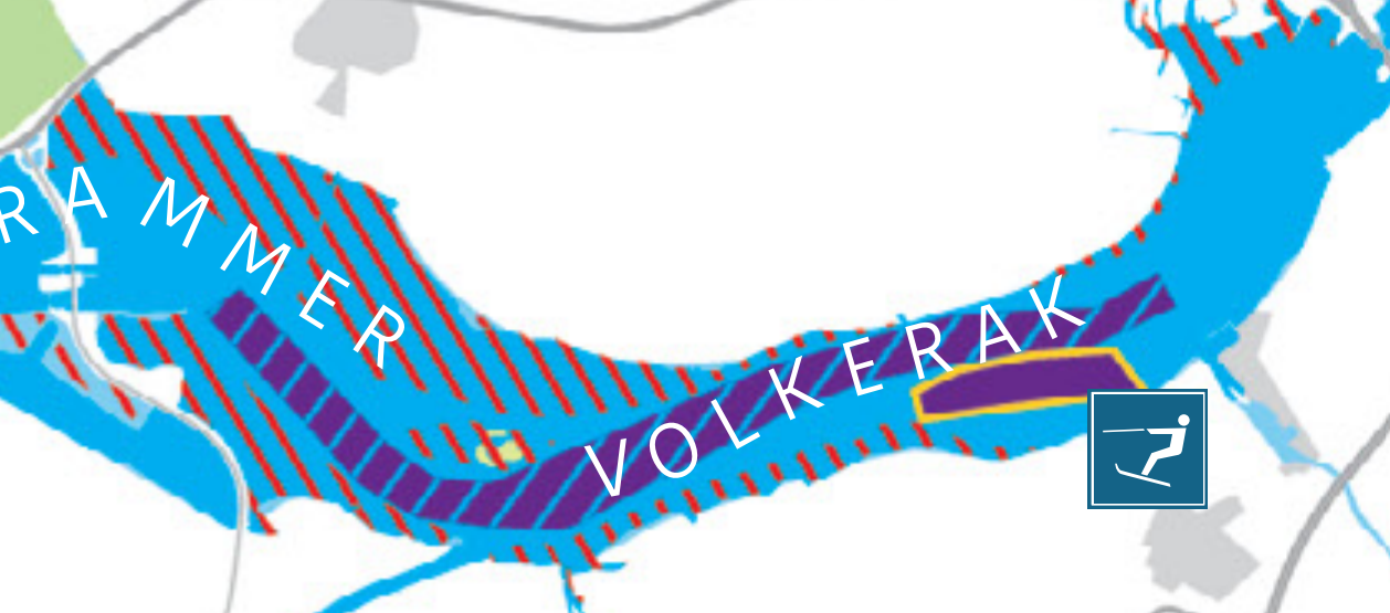
Volkerak (Click on the image to enlarge the map)
 |
 |
|
Course map by the organisation (Source: Savvy Navvy)
|
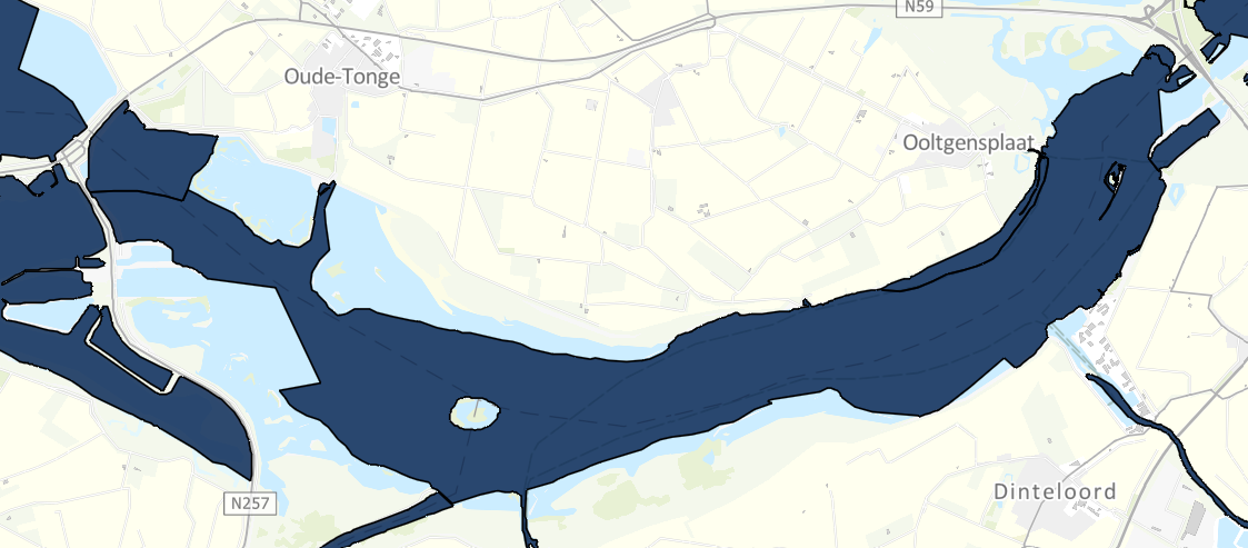
Sportvisserij Nederland map (Source: vissplanner.nl)
Note: Possession of the Visplanner app or waterbooks is mandatory. Prohibited areas such as Natura 2000 and yellow buoys with red-white-red tops are not shown on this map. |
 |
|
|
Fast-speed zones (Source: www.varendoejesamen.nl):
|
|
